

Ina's rock is readily accessible by firstly walking from Alton Bridge eastwards along the disused railway track to an under-bridge with white railings some 200m from the car park. The route is either along the disused railway track a further 500m or a detour along the old canal route to the left which has recently been refurbished by the canal society. We normally choose the canal route as the dead trees have been cut away to create a magical woodland path running along the canal bank. The pathway is soft under foot so boots or wellies are recommended. Stay alert for heron fishing in the ditch to the right, and buzzard swooping low to feed on wood pigeon. Blue and Great Tits chase one another amongst the trees, and grey squirrels work tirelessly gathering food. The ground covering is spectacular in spring with a carpet of bluebells.
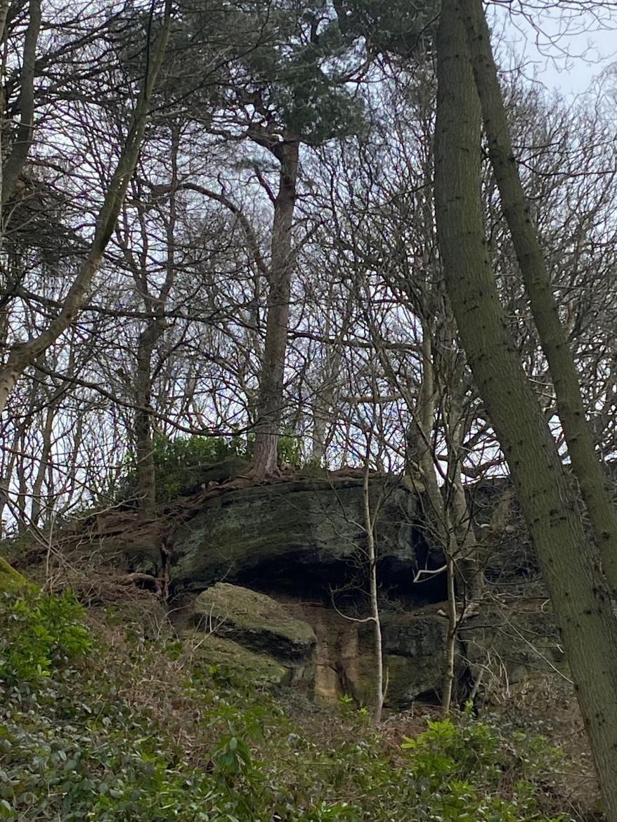
The old canal basin is crossed by the woodland path climbing north-east wards up the north side of the Churnet valley. By following this path for a further 500m Ina's rock is found extruding from the hillside to a height of approx 30m above the forest floor. This is a favourite spot for climbers and features in the UK Climbing Club website. The climbers anchor their ropes to the pine trees located precariously on the top of Ina's rock. The pines trees root system lock onto Ina's crevices for dear life.(Pic 1 & 2)
Ina's rock was formed during the Triassic period 250 million years ago. Large rivers deposited sands and pebbles over the eroded carboniferous rock formation. As the highlands gradually lowered rivers began to meander and produce finer grained rock beds. The rock beds were later fractured and faulted by late Triassic earth movements associated with the opening of the Atlantic Ocean.Cross bedding is evident where grit and pebbles are sandwiched between finer sandstone beds.(Pic 3).
A return route is possible by walking a further 500m up the woodland hillside to the top of the hill. On a clear day, Denstone village church spire is visible from the hilltop looking east. On reaching the top of the hill a stream splits the hillside to the northeast. Follow this eroded path down to Bridge 70, another spectacular restoration project completed by the Canal Trust. Once across bridge 70, follow the newly formed grey grit footpath to the right westwards for a further 200m where we join the disused railway again. Turn right onto the track bed to return back down the track bed to Alton Bridge or turn left and walk 4 miles to Denstone village. Enjoy the beauty of the sandstone architecture of Denstone Church or a cup of coffee at the award winning Denstone Farm shop.
Walking halfway back along the railway track are two benches in memory of two friends who walked this route and enjoyed the tranquility of the Churnet valley.
![]()
![]()